Search by voice
Windows
Mac
Windows
Log in / Sign up
Windows
›
Tags › AutoCAD maps
Most popular
AutoCAD Maps
software
Relevance
Popularity
Rating
Autodesk Design Review
free
107,627
Autodesk, Inc.
Autodesk Design Review is a CAD viewer that allows you to view...
Autodesk Design Review is a CAD viewer that allows you to view, mark up, print, and track changes
Rhinoceros
22,503
McNeel & Associates
Rhinoceros is a powerful program that allows you to create complex models...
Rhinoceros is a powerful program that allows you to create complex models. It provides enhanced
AutoCAD LT
13,813
Autodesk
Computer-aided design
Computer-aided design
ExpertGPS
9,484
TopoGrafix
ExpertGPS is a GPS map software, which helps you plan outdoor adventures. It can show GPS waypoints and tracklogs...
ExpertGPS is a GPS map software, which helps you plan outdoor adventures. It can show GPS waypoints
Img2CAD
6,477
Img2CAD LLC
In order to edit and improve raster images using AutoCAD, you will need to transform them into vector images...
In order to edit and improve raster images using AutoCAD
AutoCAD Map 3D
5,346
Autodesk, Inc.
AutoCAD Map 3D is a complex tool for mapping, infrastructure planning and management that allows for CAD and GIS...
AutoCAD Map
3D is a piece...they are assigned to.
AutoCAD Map
3D is a complex
AutoCAD Raster Design
2,420
Autodesk Inc.
AutoCAD Raster Design is a comprehensive software program used to create, edit and analyze 3D projects...
Create, edit, and analyze 3D projects that include raster graphics. AutoCAD Raster Design works
DesignCAD 3D MAX
2,333
TurboCAD
DesignCAD 3D MAX is an easy-to-use 2D/3D CAD tool, which is perfect for novice designers...
DesignCAD 3D MAX is an easy-to-use 2D/3D CAD tool, which is perfect for novice designers
TurboCAD Deluxe
1,754
IMSI/Design
TurboCAD Deluxe is a software program for users of Windows operating systems who may be architects...
TurboCAD Deluxe is a software program for users of Windows operating systems who may be architects
CAD Viewer
1,504
Guthrie CAD/GIS Software Pty Ltd.
CAD Viewer is a powerful application that can display CAD files like DXF and DWG...
CAD Viewer is a powerful application that can display CAD files like DXF and DWG drawings
Vextractor
822
VextraSoft
Vextractor is a vectorizer program for transforming raster images...
Vextractor is a vectorizer program for transforming raster images into vector formats by building
AcroPlot
616
CADzation
Includes a full version of the PDF Printer Driver to create PDF files from any application. Converts all major office...
Includes a full version of the PDF Printer Driver to create PDF files from any application. Converts
FlashCAD
445
Digitarch
2D 3D Geometric Entities and Bitmap management, 3D Rendering and Animation, Inverse Perspective...
With FlashCAD you will discover the pleasure of drawing thanks to the easiest and most complete
Autodesk Land Desktop 2005
free
431
Autodesk
Autodesk has released Autodesk® Land Desktop 2005 Service Pack 1...
Autodesk has released Autodesk® Land Desktop 2005 Service Pack 1, which addresses several known
RoboGEO
406
Pretek, Inc.
RoboGEO is a practical application that enables us to input geocoding data into maps...
RoboGEO's approach is "software only" and that makes it less expensive, more convenient
R2V
297
MR Soft
R2V is a tool for converting raster images to vector by drawing...
R2V is a tool for converting raster images to vector by drawing centerlines and outlines.R2V
Eye4Software Hydromagic
250
Eye4Software B.V.
Hydrographic Survey Software for Windows, Load topographic or nautical maps, create singlebeam soundings...
Eye4Software Hydromagic is hydrographic survey software for Windows. It can be used to generare
MAP
216
Autodesk
CARIS Easy View
free
172
CARIS
CARIS Easy View is a free 2D and 3D spatial data viewer. Users can load multiple raster...
CARIS Easy View is a free 2D and 3D spatial data viewer. Users can load multiple raster, point cloud
ConceptDraw WebWave
4
Computer Systems Odessa
ConceptDraw WebWave is a software for web site/application prototyping and design...
ConceptDraw WebWave is an essential tool on the stage of web site/application prototyping and design
1
2
3
4
Tags
Cad
Dxf
Image
Map
Dwg
Design
Bmp
Vector
Raster
2009
Featured stories
See all
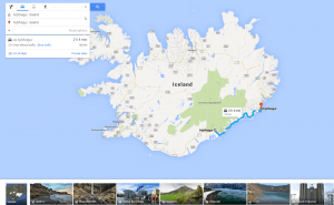
More Opportunities For Trips With Google Maps
Google Maps has recently released a new set of features that will definitely improve user traveling experience.
Mind Mapping Tools: Not To Lose Bright Ideas
Here goes a list of mind mapping tools that will surely help visual thinkers avoid half-concepts and patchy schemes while brainstorming.
New Bing Maps Preview Focuses On Travelling Plans
Bing Maps Preview has just been updated with a few features that make planning your trips much more convenient.
Halo 5's map editor is now available for free in Windows 10
Unfortunately, Microsoft didn't give us any official information about when or if the game itself will be coming to Windows 10.
Draw on Windows Maps
The default Maps app that Windows offers gives you some very handy drawing options. Here's everything that you need to know about it.